

Storm expected to start tomorrow, leading into the Christmas weekend
You may want to consider changing your holiday plans.
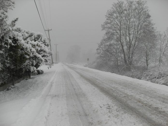
A major winter storm is still on track to hit several parts of the province starting tomorrow.
A special weather statement is in effect for many areas, including Niagara.
Environment Canada says rain can be expected tomorrow night.
On Friday, the temperature will drop, and some areas could get a flash freeze.
The colder weather is also expected to bring strong winds around 100 km/h on Friday, as well as heavy snow.
Environment Canada says the area could get could be between 5 and 15 cm of snow by Saturday morning.
Areas east of the Great Lakes can expect a couple of days days of snow into the weekend.
For communities downwind of Lake Huron and Georgian Bay, blizzard conditions are possible late Friday into the weekend.
Environment Canada warns there could be extensive utility outages.
If you do head out, you're advised to have an emergency plan and an emergency kit with drinking water, food, medicine and first aid supplies.
The City of Niagara Falls is reminding residents not to park on roads during the storm, as it could get in the way of plows.
Meanwhile, closer to Buffalo, a winter storm watch and a lakeshore flood watch have been issued for several counties including Niagara, Erie and Chautaqua.
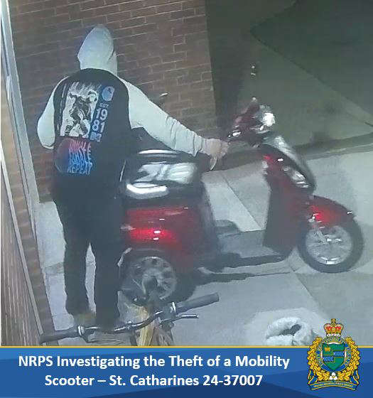 NRP Searching for Stolen Scooter
 Sullivan Park Receiving Playground Upgrades
 Police Looking for Missing Woman
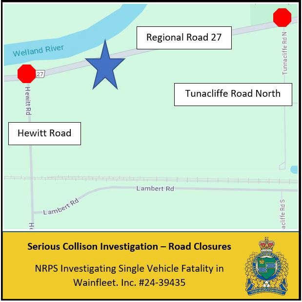 Man Killed in Wainfleet Crash
 Police Arrest Another Assault Suspect
 Picture of Assault Suspect Released
 Premier Fumes Over Gas Price Increase